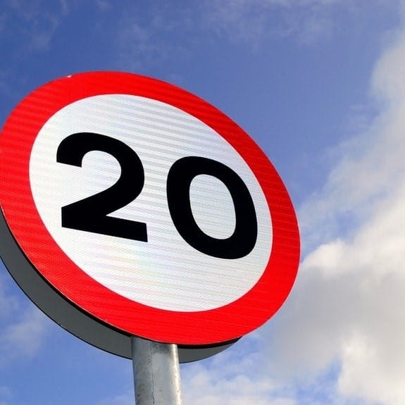
20mph Speed Limit scheme - Phase 2
The survey has now closed, thank you for your contributions.
All comments from this phase will be reported to Committee in the Autumn and members will have the final say on whether this phase of the scheme proceeds to implementation.
In 2022, the council undertook consultation for 20mph speed limits in 15 areas around Wirral. The results of this were reported to the Environment, Climate Emergency and Transport committee on 30 January 2023, where committee approved the roll out of 20mph speed limits in these areas. Work started in spring of this year and is due to be complete in Autumn 2023.
As part of the council’s commitment to Liverpool City Region’s Vision to Zero Road Safety Strategy, the council is planning to introduce more 20mph speed limits across Wirral.
Between the end of June and end of August 2023, we will be consulting on the next 15 areas.
More information about these areas, including a map, and their consultation periods can be found below.

Click here to search and interact with the map
Use the link above, to click through to the full map, where you can see the new proposed areas, see existing 20mph speed limit areas, and/ or search roads to see if where you live or travel through is in a proposed area for 20mph speed limits.
Residents are invited to share their views on 20mph speed limits in their local area, by taking part in the survey and selecting the area that they would like to comment on. Consultation will take place in phased stages – so different areas will be available to comment on at different times. The feedback collected will be reported to the Council's Environment, Climate Emergency and Transport Committee for review and decision making in the Autumn.
Phase 2 of the 20mph speed limit scheme is funded by the Liverpool City Region Sustainable Transport Settlement Combined Authority Transport Plan, which was approved at the Environment, Climate Emergency and Transport committee meeting on 14 March 2023.
Area | Wards Affected | Start of consultation period | End of consultation period |
| 50 | Hoylake & Meols | 28/06/2023 | 26/07/2023 |
| 44 | Heswall Greasby, Frankby & Irby Pensby & Thingwall | 28/06/2023 | 26/07/2023 |
| 11 | Birkenhead & Tranmere | 28/06/2023 | 26/07/2023 |
| 34 | Leasowe & Moreton East Upton Bidston & St James | 05/07/2023 | 02/08/2023 |
| 36 | Moreton West Saughall Massie | 05/07/2023 | 02/08/2023 |
| 31 | Bidston & St James | 05/07/2023 | 02/08/2023 |
| 35 | Moreton West Saughall Massie | 12/07/2023 | 09/08/2023 |
| 20 | Bebington | 12/07/2023 | 09/08/2023 |
| 30 | Bidston & St James Claughton | 12/07/2023 | 09/08/2023 |
| 10 | Birkenhead & Tranmere Claughton | 19/07/2023 | 16/08/2023 |
| 21 | Bebington Clatterbridge | 19/07/2023 | 16/08/2023 |
| 1 | New Brighton Seacombe Liscard | 19/07/2023 | 16/08/2023 |
| 3 | Seacombe Liscard | 26/07/2023 | 23/08/2023 |
| 8 | Seacombe Birkenhead & Tranmere Bidston & St James | 26/07/2023 | 23/08/2023 |
| 15 | Prenton Rock Ferry Bebington | 26/07/2023 | 23/08/2023 |
The areas listed below will be consulted on in subsequent phases of the consultation:
Area | PHASE 3 – Area boundary -all adopted highway under Wirral council control included – unless stated otherwise on map. |
Wards affected |
13 | Woodchurch Rd / Borough Rd / Oxton Rd / Whetstone La | Oxton and Birkenhead & Tranmere |
17 | Rock Ferry Bypass / New Chester Rd / New Ferry Rd | Rock Ferry and Bromborough |
24 | Brimstage Rd / Spital Rd / M53 / Brotherton Park | Clatterbridge |
5 | Corporation Road / Wallasey Bridge Road / Dock Rd | Seacombe and Bidston & St James |
42 | Landican La / Barnston Rd / Storeton La | Pensby & Thingwall |
48 | Thurstaston Rd / Thingwall Rd / Common / Limbo Lane | Greasby, Frankby & Irby |
6 | Dock Rd / Gorsey Lane / Poulton Road | Seacombe |
18 | Esplanade / Rock Ferry Bypass / New Ferry Bypass | Rock Ferry and Bromborough |
51 | Upton Bypass / Moreton Rd / Arrowe Park Rd | Upton |
19 | Mount Rd / Bracken La / Teehey La/ Broadway | Bebington |
27 | Neston Rd / Grange Rd | Clatterbridge |
32 | Fender La / Hoylake Rd / M53 / Bidston Village Rd | Bidston & St James |
37 | Saughall Massie Rd / West Kirby Rd / Pump La / Greasby Rd | Greasby, Frankby & Irby, Moreton West & Saughall Massie and Hoylake & Meols |
39 | Greasby Rd / Frankby Rd | Greasby, Frankby & Irby |
40 | Greasby Rd / Upton Bypass / Arrowe Park Rd | Greasby, Frankby & Irby |
Area | PHASE 4 – area boundary -all adopted highway under Wirral council control included – unless stated otherwise on map |
Wards affected |
29a | Woodchurch Road / Arrowe Park Road / Upton Bypass / M53 | Upton |
26 | Thornton Hough - Neston Rd / Raby Rd | Clatterbridge |
38 | Pump La / Frankby Rd | Greasby, Frankby & Irby |
41 | Hill Bark Rd / Arrowe Brook La / Arrowe Rd | Greasby, Frankby & Irby |
43 | Barnston Rd / Pensby Rd | Pensby & Thingwall |
45 | Brimstage Rd / Whitehouse La / Barnston Rd | Heswall |
46 | Brimstage Rd / Manor Wood / Chester High Rd | Heswall |